Using satellite technology, the first continent-wide mapping study of plant life across Antarctica reveals growth in previously uncharted areas and is set to inform conservation measures across the region.
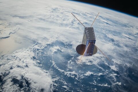
Scientists employed a European Space Agency satellite to sweep the continent, along with field measurements taken over several summer seasons. This combined approach detected almost 45 square kilometres of vegetation — roughly three times the size of Lake Windermere, in England.
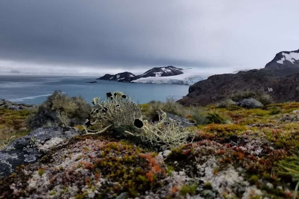
The survey of mosses, lichens and algae across the continent will form a baseline for monitoring how Antarctica’s vegetation responds to climate change.
Vital to protect tiny fraction of ice-free area
The international team, led by the University of Edinburgh with the Norwegian Institute for Nature Research (NINA), British Antarctic Survey and Scottish Association for Marine Science, found that over 80% of the vegetation growth was contained within the Antarctic Peninsula and neighbouring islands.
The team estimates this growth makes up only 0.12% of Antarctica’s total ice-free area, highlighting the importance of monitoring key areas of vegetation abundance, which experts say is inadequately protected under the existing Antarctic Specially Protected Area (ASPA) system.
Key barometers of regional climate change
Antarctic vegetation, dominated by mosses and lichens, has adapted to survive the harsh polar conditions and each type plays an important role in carbon and nutrient recycling on a local level.
Until now, however, the spatial coverage and abundance across the continent remained unknown.
Previous research has shown that the environmental sensitivity of Antarctica’s vegetative species makes them excellent barometers of regional climate change. Monitoring their presence in Antarctica, a minimally disturbed landscape, could provide clues as to how similar vegetation types may respond to climate in other fragile ecosystems across the globe, such as parts of the Arctic.
The scale of the findings is key to the importance of the survey, explains Charlotte Walshaw, PhD researcher from the School of GeoSciences, University of Edinburgh, who led the study:
“Our continent-scale map provides key information on vegetation presence in areas that are rarely visited by people. This will have profound implications for our understanding of where vegetation is located across the continent, and what factors influence this distribution.”
Harshest living conditions on the planet
The locational data will help drive Conservation efforts, adds Dr Claudia Colesie, researcher and Senior Lecturer at the University of Edinburgh’s School of GeoSciences, who also took part in the study:
“Lichens and mosses in Antarctica encounter the harshest living conditions on the planet on a daily basis. Only the most resilient organisms can thrive there. Now that we know where to look for them, we can provide more targeted conservation measures to safeguard their future.”
Low-impact benefits of of remote sensing
The use of satellite technology offers clear environmental sustainability benefits, explains Dr Andrew Gray, researcher at the Norwegian Institute for Nature Research (NINA), who jointly led the study:
“Remote sensing approaches such as this are low impact methods to study Antarctica’s fragile ecosystem as well as monitor change to its vegetation in the future.”
The research, published in Nature Geoscience, was funded by the Natural Environment Research Council (NERC) and UK Space Agency. Field campaigns were supported by the British Antarctic Survey, Instituto Antarctic Chileno (INACH), and Antarctica New Zealand.
Further Reading:
- Read the research paper in full, as published officially in Nature Geoscience;
- More about the School of Geosciences at the University of Edinburgh;
- More about the Norwegian Institute for Nature Research (NINA;
- More about British Antarctic Survey, part of the Natural Environment Research Council (NERC);
- More about the Scottish Association for Marine Science, based in Oban, Argyll;
- More about the European Space Agency and its satellite programmes;
- Also on SustMeme, Satellites and AI to map biodiversity of highways;
- Also on SustMeme, Space satellites launch to detect ‘dark ships’;
- Also on SustMeme, Giant iceberg the size of Los Angeles breaks off Antarctica;
- Also on SustMeme, Crowdsourcing AI to fight deforestation.
Check out the full archive of stories under the SustMeme Biodiversity & Conservation topic.